What is a Geohash?
A geohash is a string representation of a geographic location, encoded as a series of characters. This encoding allows for efficient storage and querying of spatial data. Geohashes are hierarchical, meaning that as the string length increases, the represented area becomes more precise.
How Geohashes Work
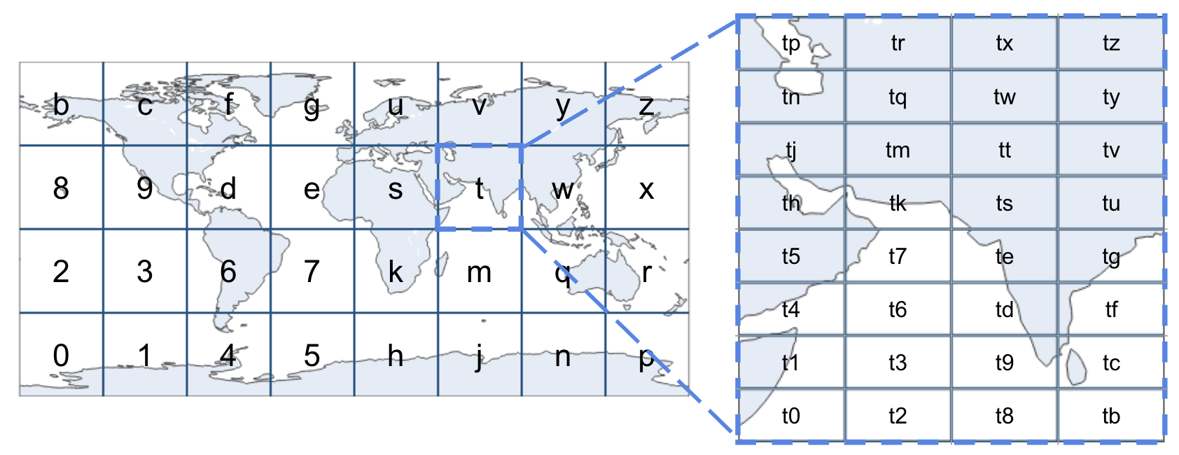
Geohashes divide the world into a grid of cells, each with a unique identifier (encoded in base 32). The precision of the geohash can be adjusted by changing its length:
- Short geohashes represent larger areas.
- Long geohashes represent smaller, more precise areas.
| Geohash Length | Lat Bits | Lng Bits | Lat Error | Lng Error | Km Error |
|---|---|---|---|---|---|
| 1 | 2 | 3 | ±23 | ±23 | ±2,500 km (1,600 mi) |
| 2 | 5 | 5 | ±2.8 | ±5.6 | ±630 km (390 mi) |
| 3 | 7 | 8 | ±0.70 | ±0.70 | ±78 km (48 mi) |
| 4 | 10 | 10 | ±0.087 | ±0.18 | ±20 km (12 mi) |
| 5 | 12 | 13 | ±0.022 | ±0.022 | ±2.4 km (1.5 mi; 2,400 m) |
| 6 | 15 | 15 | ±0.0027 | ±0.0055 | ±0.61 km (0.38 mi; 610 m) |
| 7 | 17 | 18 | ±0.00068 | ±0.00068 | ±0.076 km (0.047 mi; 76 m) |
| 8 | 20 | 20 | ±0.000085 | ±0.00017 | ±0.019 km (0.012 mi; 19 m) |
For example, the following geohashes are all within a maximum distance of +/- 78km (48mi) from each other:
- s008nb00j8
- s00twy01mt
- s00j8n012j
However, these geohashes represent completely different regions:
- s128nb00j8
- s34twy01mt
- s56j8n012j
Benefits of Using Geohashes
- Compact Representation: Efficiently stores geographic coordinates.
- Hierarchical Structure: Allows for easy aggregation and precision adjustment.
- Proximity Queries: Simplifies the process of finding nearby locations.
Check out the Geohash Explorer for an interactive map to help visualize geohashing.